

Maps and Atlases
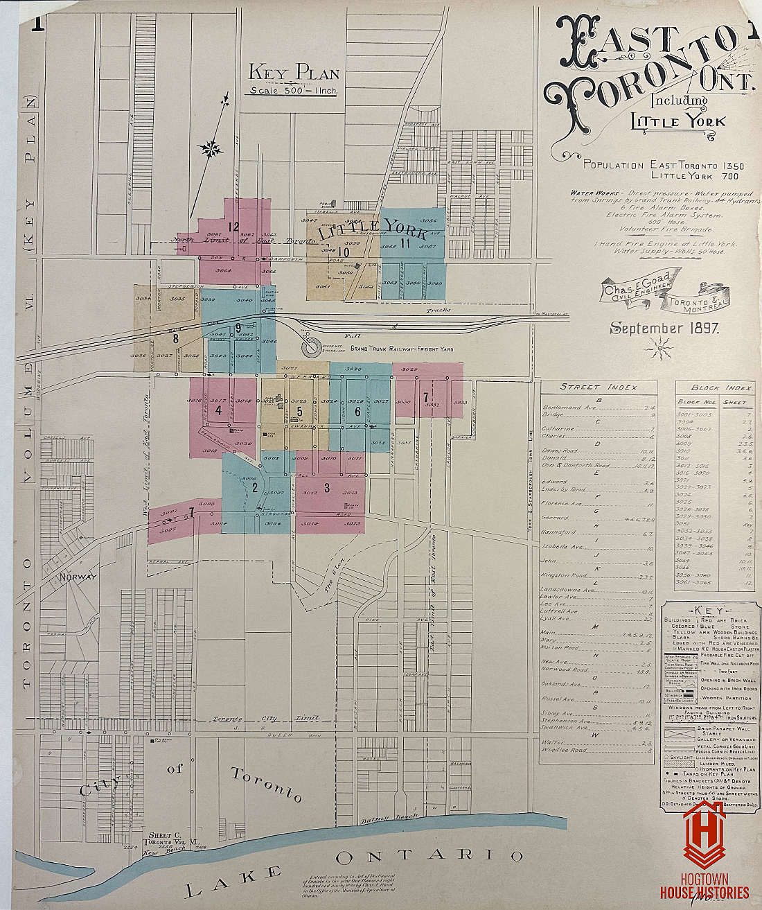
Note: Two Plan 7s are shown on the Key Plan, but the single detailed image of Plan 7 shows both geographically separated areas. The top shows Gerrard near Lawlor, the bottom shows Kingston Road at Lee.
Note: Two Plan 7s are shown on the Key Plan, but the single detailed image of Plan 7 shows both geographically separated areas. The top shows Gerrard near Lawlor, the bottom shows Kingston Road at Lee.